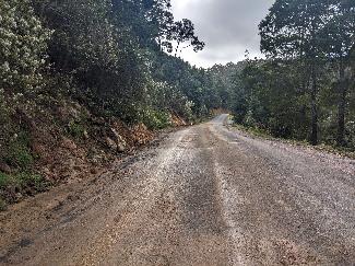
Upper Natone - Horseshoe Bend Updates

Published on 09 February 2024

Upper Natone.png

Upper Natone Road – Road Open to Single Lane Only - 5t limit applies


$7.5 million from the Capital Works Program 2023-24 has been allocated to repair the significant road damage caused by the October 2022 rain event across the municipality. Read more about it in Councils Annual Plan and Budget Estimates 2023-24

CC Tile.PNG


As remediation designs are ongoing, Council will update the public with new information when it becomes available. 

Thank you so much for the community’s patience and the positive responses we have received, as we continue to work hard for you on what we know is a huge issue in your area.


Updates:

24 April 2024

  • Hardings Hotmix have sealed the gravel areas on Upper Natone Rd and will be off-site until Spring 2024.
  • 40km zone still in place along with a single lane section to the south of 512 Upper Natone Rd’s driveway for around 50m, with give way signs
  • A creek investigation report for the pipe & road realignment design is being finalised by GeoTon
  • PDA have surveyed the creek and will start on design once the GeoTon’s report is finished
  • Natural State are organising hydro-mulching and jute matting for the areas disturbed around the new drain
  • Hardings Hotmix will install a 25,000L tank when they install the grate protection at the top headwall
2024-04-23 1.JPG

Above: The gravel road has been sealed and Hardings Hotmix will return to the site in Spring 2024.  

2024-04-23 3.JPG


9 February 2024

  • The rock filled drain has been completed
  • High density polyethylene pipes have been laid down the hill
  • The first manholes and culverts for the road crossing have been installed
  • Work on the headwall and inlet has commenced
  • Single Lane and existing traffic limits remain in place, despite various trucks passing through site during inspection
  • Pinion are still awaiting final approvals so test holes can be dug in creek
2024-02-09 horseshoe.png

Above: High density polyethylene pipes have been laid down the hill


22 January 2024

  • The diversion drain above the landslip is being protected with Terramesh rock filled baskets
  • There will be culvert works commencing in the coming weeks to take the drain across Upper Natone road
  • This will involve 1 lane traffic and some delays
22 Jan HS.PNG

Above: The diversion drain above the landslip is being protected with Terramesh rock filled baskets


Thank you so much for the community’s patience and the positive responses we have received, as we continue to work hard for you on what we know is a huge issue in your area.


06 December 2023

Contractor Harding’s Hotmix have almost completed the main drain dig out from the top to the road. This drain will take the water that once sat in the illegal dams away from the landslip zone and into the creek. 

The final design of the road crossing is being worked on to balance suitable design and minimise disturbance to local residents.

Road Cut Down Dec 223.PNG

The cut down to the road that will be piped & backfilled

Old upper road dam.PNG

Location of where the old upper dam was
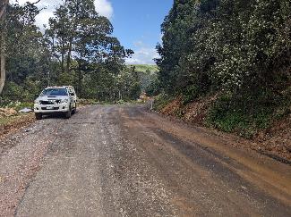
Thank you so much for the community’s patience and the positive responses we have received, as we continue to work hard for you on what we know is a huge issue in your area.


20 November 2023

Harding Hotmix have completed the decommissioning of the two dams above Upper Natone Road, with works commencing on the top drain. 

Traffic control is still in place with the single lane in operation. 

November 21.PNG

Decommissioning of the two upper dams

Thank you so much for the community’s patience and the positive responses we have received, as we continue to work hard for you on what we know is a huge issue in your area.


02 November 2023

Harding Hotmix are continuing with the complex drainage works, alongside decommissioning the two dams above the road.  The Spring weather has allowed our teams to increase the verge clean ups areas, allowing for a longer stretch of road.

Nov 2.PNG

Verge Clean ups. Providing longer stretch of road 

Thank you so much for the community’s patience and the positive responses we have received, as we continue to work hard for you on what we know is a huge issue in your area.


27 October 2023

  • Batter failures and verge clean ups have been completed providing a longer stretch of 2 lane road
  • One Lane road is still in use through the main slip zone in front of 512 Upper Natone Road
  • Natural Value studies have commenced in the creek to determine best practice during civil works
  • Harding’s have commenced drainage works near the top dam
HS 27 Oct 2.jpg  HS 27 Oct.jpg

Verge clean ups underway, providing a longer stretch of 2 lane road

Thank you so much for the community’s patience and the positive responses we have received, as we continue to work hard for you on what we know is a huge issue in your area.


20 October 2023

GeoTon have completed test holes on top of the main road cut batter, to determine how deep the slip plane is for batter design.

Hardings will commence work on Monday 23 October 2023. They will:

  • Clean up the inside verges to allow two way traffic for a longer stretch
  • Install new traffic control centred around the driveway – one lane
  • Start drain & decommissioning dam works from the top dam  
  • General shape will be 3m wide trench (Excavator tracks) and side batters to suit stability
  • From the top dam to lower dam it will be lined with Grassroots to prevent erosion
  • Subsoil drains will be installed with no return valves and exit into the drain
  • Both Dams will be decommissioned 

From the lower dam down to the road it is still undecided on the best approach. A similar trench will be cut to start with to determine what site conditions are. Options for this section include:

  • Reno Mattress
  • Pipe if no subsoil drainage issues are found
  • Mesh & Shot Crete if ground conditions are suitable
  • Dissipation methods
  • Box Culvert crossing the road

Surveyors have options ready once they know what they are dealing with, but they won’t know what they are dealing with until they get in there.

The preferred road repair solution is to pipe the creek and move the road onto the top of it. Hardings will cut a track into the creek on Tuesday 24 October. GeoTon and Natural State will be onsite to inspect ground conditions for suitability and conduct a Natural Values Report. Once the surveyors have gathered all the information from Tuesday, a proposal will be developed. 

Grassroots.PNG

Grassroots 2.PNG

Grassroots® is made in Australia from heavily UV stabilised synthetic fibres which are needle-punched together into an open weave three-dimensional structure, designed to offer a permanent engineered solution that assists the establishment of vegetation even in extreme environmental conditions.


Thank you so much for the community’s patience and the positive responses we have received, as we continue to work hard for you on what we know is a huge issue in your area.


11 October 2023

Clearing was created for the proposed drainage channel, with drainage works from the Upper Dam to the road crossing commencing from the last week of October. 

Please note: Access issues have caused delays in the works, despite access to the site being granted. 

Road design alternatives are being considered to keep the road open during the repair works. 

Oct 11.1.PNG

The site for the drainage channel has ben cleared 

Oct 11.2.PNG


Oct 11.3.PNG


Thank you so much for the community’s patience and the positive responses we have received, as we continue to work hard for you on what we know is a huge issue in your area.


28 September 2023

Initial site works began the second week of September 2023 around the dams (above Horseshoe Bend) to determine drainage path & depths. The delay in being able to begin the remediation works has been due to obtaining access to this private property. Both dams contributed significantly to the ground saturation which is a major factor in the landslip issues. 

Test holes have been dug around these existing dams and have determined that the ground water is up to 4.5m deep. This water needs to be intercepted by the new drain to stop the ground saturation. Both dams have contributed significantly to the ground water issues due to no spillways and extremely poor construction. Therefore, both dams will be decommissioned.

Having gained direct access, we have now determined the best modelling for the final drainage required. Hardings have been engaged and will begin to build the drain in the coming weeks. 

Our engineers on site will be continuing to decommission the dams over the next 3 to 4 weeks. 

Drainage plan Sep 2023.PNG

Above: Drainage Plan 

Saturated soft clays with landslide area.JPEG

Saturated soft clays within landslide area 

Saturated soils within landslide area.JPEG

Saturated soft clays within landslide area 

Test pit along drainage path.JPEG

Test Pit along drainage path 

Thank you so much for the community’s patience and the positive responses we have received, as we continue to work hard for you on what we know is a huge issue in your area.


Friday 8 September 2023


Friday 14 July 2023

Consultant engineers are 80% complete for the final drainage plans. Drainage works will need to include flexible energy dissipating drain systems in order to control the vertical water flow properly. This will eradicate destructive impacts of water flow, due to the elevation. 

Drain example.PNG

Example of a flexible energy dissipating drain system diagram

Pic drainage system.PNG

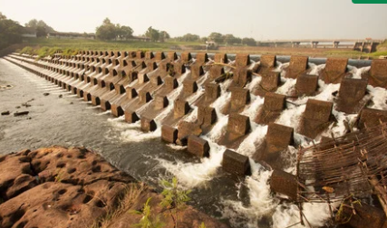
Example of a large flexible energy dissipating drain system. Reduce the pressure of water from the dam.

Council are also awaiting permission from local land owners, in order to gain access to begin the first stages of the remediation works. 

We are committed to investing $7.5 million dollars provide by both State Government funding and Burnie City Councils renewal contribution to the project. 

Thank you so much for the community’s patience and the positive responses we have received, as we continue to work hard for you on what we know is a huge issue in your area.


Thursday 25 May 2023

Consultant engineers are near completion of the final drainage plan. Concepts for road works have been submitted for review. Drainage works are proposed to as soon as possible with road reconstruction work to commence after winter.

Thank you so much for the community’s patience and the positive responses we have received, as we continue to work hard for you on what we know is a huge issue in your area.


Friday 12 May 2023

Remediation plans and designs for Horseshoe Bend road are still progressing. 

Thank you so much for the community’s patience and the positive responses we have received, as we continue to work hard for you on what we know is a huge issue in your area.


Friday 5 May 2023

Remediation plans and designs for Horseshoe Bend road are still progressing. 

Thank you so much for the community’s patience and the positive responses we have received, as we continue to work hard for you on what we know is a huge issue in your area.


Friday 28 April 2023

Assessment and remediation plans for Horseshoe Bend road reconstruction is continuing. Due to the design being quite intricate, this process will take further time to complete to ensure the absolute prolonged safety of road users.

Thank you so much for the community’s patience and the positive responses we have received, as we continue to work hard for you on what we know is a huge issue in your area.


Friday 21 April 2023

Assessment and remediation plans for Horseshoe Bend road reconstruction is continuing. 

Thank you so much for the community’s patience and the positive responses we have received, as we continue to work hard for you on what we know is a huge issue in your area.


Any individual or business impacted by the flood event, including those effected by these road closures are eligible to apply for Tasmanian Recovery Funding through the Tasmanian Government: Tasmanian Financial Support - Severe Weather Event - October 2022

You can call the Tasmanian Emergency Information Service on 03 6145 5303 for help filling out and completing the grant application forms.

You can also visit the Burnie Public Library @ 30 Alexander Street Burnie.

They are happy to assist in completing the applications. A volunteer available at the Library on Mondays, Tuesdays and

Wednesdays from 9:30a.m. until 12:00 p.m.


Friday 14 April 2023

Design work is continuing on road reconstruction to re-establish the current road location. 

Thank you so much for the community’s patience and the positive responses we have received, as we continue to work hard for you on what we know is a huge issue in your area.


Any individual or business impacted by the flood event, including those effected by these road closures are eligible to apply for Tasmanian Recovery Funding through the Tasmanian Government: Tasmanian Financial Support - Severe Weather Event - October 2022

You can call the Tasmanian Emergency Information Service on 03 6145 5303 for help filling out and completing the grant application forms.

You can also visit the Burnie Public Library @ 30 Alexander Street Burnie.

They are happy to assist in completing the applications. A volunteer available at the Library on Mondays, Tuesdays and

Wednesdays from 9:30a.m. until 12:00 p.m.

­­­­­­­­­


Friday 7 April 2023

Design work is continuing on road reconstruction to re-establish the current road location.

Thank you so much for the community’s patience and the positive responses we have received, as we continue to work hard for you on what we know is a huge issue in your area.


Any individual or business impacted by the flood event, including those effected by these road closures are eligible to apply for Tasmanian Recovery Funding through the Tasmanian Government: Tasmanian Financial Support - Severe Weather Event - October 2022

You can call the Tasmanian Emergency Information Service on 03 6145 5303 for help filling out and completing the grant application forms.

You can also visit the Burnie Public Library @ 30 Alexander Street Burnie.

They are happy to assist in completing the applications. A volunteer available at the Library on Mondays, Tuesdays and

Wednesdays from 9:30a.m. until 12:00 p.m.

­­­­­­­­­


Friday 31 March 2023

The final design for the drainage work on Horseshoe bend has been completed. The implementation of the drainage remediation work will begin prior to the road reconstruction. 

Thank you so much for the community’s patience and the positive responses we have received, as we continue to work hard for you on what we know is a huge issue in your area.


Any individual or business impacted by the flood event, including those effected by these road closures are eligible to apply for Tasmanian Recovery Funding through the Tasmanian Government: Tasmanian Financial Support - Severe Weather Event - October 2022

You can call the Tasmanian Emergency Information Service on 03 6145 5303 for help filling out and completing the grant application forms.

You can also visit the Burnie Public Library @ 30 Alexander Street Burnie.

They are happy to assist in completing the applications. A volunteer available at the Library on Mondays, Tuesdays and

Wednesdays from 9:30a.m. until 12:00 p.m.


Friday 24 March 2023

Design work is continuing on drainage and road reconstruction to re-establish the current road location.

Thank you so much for the community’s patience and the positive responses we have received, as we continue to work hard for you on what we know is a huge issue in your area.


Any individual or business impacted by the flood event, including those effected by these road closures are eligible to apply for Tasmanian Recovery Funding through the Tasmanian Government: Tasmanian Financial Support - Severe Weather Event - October 2022

You can call the Tasmanian Emergency Information Service on 03 6145 5303 for help filling out and completing the grant application forms.

You can also visit the Burnie Public Library @ 30 Alexander Street Burnie.

They are happy to assist in completing the applications. A volunteer available at the Library on Mondays, Tuesdays and

Wednesdays from 9:30a.m. until 12:00 p.m.

­­­­­­­­­


Friday 17 March 2023

Design work is continuing on drainage and road reconstruction to re-establish the current road location.

Thank you so much for the community’s patience and the positive responses we have received, as we continue to work hard for you on what we know is a huge issue in your area.

­­­­­­­­­­­­


Any individual or business impacted by the flood event, including those effected by these road closures are eligible to apply for Tasmanian Recovery Funding through the Tasmanian Government: Tasmanian Financial Support - Severe Weather Event - October 2022

You can call the Tasmanian Emergency Information Service on 03 6145 5303 for help filling out and completing the grant application forms.

You can also visit the Burnie Public Library @ 30 Alexander Street Burnie.

They are happy to assist in completing the applications. A volunteer available at the Library on Mondays, Tuesdays and

Wednesdays from 9:30a.m. until 12:00 p.m.


Friday 10 March 2023

Investigation and evaluation work is now complete. The investigation included assessment of the subsurface conditions, possible causes for the failed section of road, remediation recommendations and geotechnical parameters for pavement designs.

Image 1: Proposed Remediation Plan 

The preliminary concept design has been proposed. Geotechnical engineers have recommended to re-establish the current road location due to the alternative investigated routes deemed unfeasible (refer to image 2 and 3).

Route 1 - March 2023.png

Image 2 – Route 1 (Red Route)

Route 2 - March 2023.png

Image 3 – Route 2 (Blue Route)

Route Main - March 2023.png

Image 4 – Existing Road Layout 

EXISTING ROAD LAYOUT

  • The existing road alignment is located near the bottom of the hill and follows the contours relatively closely. This reduces steep grades and excessive cut/fill quantities.
  • Geometrically the road complies with the relevant standards.
  • Although extensive works are required to secure the landslide areas, this route is the preferred option when considering the alternatives.


Design work has commenced on drainage and road reconstruction and is expected to take up to six weeks to complete.

Thank you so much for the community’s patience and the positive responses we have received, as we continue to work hard for you on what we know is a huge issue in your area.

­­­­­­­­­­­­


Any individual or business impacted by the flood event, including those effected by these road closures are eligible to apply for Tasmanian Recovery Funding through the Tasmanian Government: Tasmanian Financial Support - Severe Weather Event - October 2022

You can call the Tasmanian Emergency Information Service on 03 6145 5303 for help filling out and completing the grant application forms.

You can also visit the Burnie Public Library @ 30 Alexander Street Burnie.

They are happy to assist in completing the applications. A volunteer available at the Library on Mondays, Tuesdays and

Wednesdays from 9:30a.m. until 12:00 p.m.


Friday 3 March 2023

Horseshoe Bend will remain restricted to one lane of traffic with a 5 ton load limit until further notice, as design work to determine the most suitable restoration solution is still ongoing. 

Thank you so much for the community’s patience and the positive responses we have received, as we continue to work hard for you on what we know is a huge issue in your area. 


Any individual or business impacted by the flood event, including those effected by these road closures are eligible to apply for Tasmanian Recovery Funding through the Tasmanian Government: Tasmanian Financial Support - Severe Weather Event - October 2022

You can call the Tasmanian Emergency Information Service on 03 6145 5303 for help filling out and completing the grant application forms.

You can also visit the Burnie Public Library @ 30 Alexander Street Burnie.

They are happy to assist in completing the applications. A volunteer available at the Library on Mondays, Tuesdays and Wednesdays from 9:30a.m. until 12:00 p.m.


Friday 24th February 2023

Work is continuing to determine the best long-term recovery options.

No new information is available at this stage.

Thank you so much for the community’s patience and the positive responses we have received, as we continue to work hard for you on what we know is a huge issue in your area. 


Clean up grant - background.PNG

Extension of Private Landowner Clean-up and Restoration Grant

(separate to the Tasmanian Recovery Funding)


Private landowners or leaseholders that have suffered direct damage from the severe weather event on 13 and 14 October 2022 can apply for a Private Landowner Clean-up and Restoration Grant to help pay for the costs of cleaning up debris and repairing damage on their property.

AMOUNT

The maximum grant amount is $10,000. In exceptional circumstances, up to $25,000 may be made available. Read the grant guidelines for more information.

ELIGIBILITY

Eligibility criteria apply. Read the grant guidelines for more information.

CLOSING DATE

Applications close at 2pm on Thursday 6 April 2023 (extended from 3 March 2023).

APPLY

Online at communitiestas.smartygrants.com.au/PLG

MORE INFO

Visit www.dpac.tas.gov.au/divisions/cpp/community-grants/clean-up-restoration-grant to read the grant guidelines and other information.

🤷🏼‍♀️ NEED SOME HELP?

If you have trouble with the application form, or if you have any questions about the application process, call the Community Grants Unit on 1800 204 224 or email grants@dpac.tas.gov.au


Any individual or business impacted by the flood event, including those effected by these road closures are eligible to apply for Tasmanian Recovery Funding through the Tasmanian Government: Tasmanian Financial Support - Severe Weather Event - October 2022

You can call the Tasmanian Emergency Information Service on 03 6145 5303 for help filling out and completing the grant application forms.

You can also visit the Burnie Public Library @ 30 Alexander Street Burnie.

They are happy to assist in completing the applications. A volunteer available at the Library on Mondays, Tuesdays and Wednesdays from 9:30a.m. until 12:00 p.m.


Friday 17th February 2023

Work is continuing to determine the best long-term recovery options.

No new information is available at this stage.

Thank you so much for the community’s patience and the positive responses we have received, as we continue to work hard for you on what we know is a huge issue in your area. 


Any individual or business impacted by the flood event, including those effected by these road closures are eligible to apply for Tasmanian Recovery Funding through the Tasmanian Government: Tasmanian Financial Support - Severe Weather Event - October 2022

You can call the Tasmanian Emergency Information Service on 03 6145 5303 for help filling out and completing the grant application forms.

You can also visit the Burnie Public Library @ 30 Alexander Street Burnie.

They are happy to assist in completing the applications. A volunteer available at the Library on Mondays, Tuesdays and Wednesdays from 9:30a.m. until 12:00 p.m.


Friday 10th February 2023

Council has received a number community requests to open the width of the lane and to increase the load limit. The latest Geotechnical engineering advice recommends that due to ongoing concerns regarding the subsurface stability, it is essential that the current restrictions remain in place for the public's safety. 

Work is continuing to determine the best long-term recovery options, including exploring an alternative route.


Traffic Management.PNG


Thank you so much for the community’s patience and the positive responses we have received, as we continue to work hard for you on what we know is a huge issue in your area. 


Any individual or business impacted by the flood event, including those effected by these road closures are eligible to apply for Tasmanian Recovery Funding through the Tasmanian Government: Tasmanian Financial Support - Severe Weather Event - October 2022

You can call the Tasmanian Emergency Information Service on 03 6145 5303 for help filling out and completing the grant application forms.

You can also visit the Burnie Public Library @ 30 Alexander Street Burnie.

They are happy to assist in completing the applications. A volunteer available at the Library on Mondays, Tuesdays and Wednesdays from 9:30a.m. until 12:00 p.m.


Friday 03rd February 2023

Our geotechnical consultants received lab testing results for the Upper Natone landslip on Monday, 16 January 2023 which will guide any potential repair work.

Findings to date:

  • The subsurface conditions within the landslide effected area of the road typically consists of clayey silt landslide deposits to depths of 1.0m to 4.0m, overlying residual clays and clayey sands (granite derived) to the investigated depths of 10.7m. Bedrock was not encountered in the investigation. 
  • Landslide deposits have pushed out into Paton Creek. There is a 1.5m vertical step of soil along the western bank of Paton Creek.
  • Monitoring surveys since the current traffic management of single lane and 5 tonne limit have shown no signs of movement along the road. 
  • Repair work to Horseshoe Bend will involve major civil construction work, potentially including concrete piers.
  • Three alternate routes are currently under investigation, each with their own specific challenges.


Thank you so much for the community’s patience and the positive responses we have received, as we continue to work hard for you on what we know is a huge issue in your area. 


Any individual or business impacted by the flood event, including those effected by these road closures are eligible to apply for Tasmanian Recovery Funding through the Tasmanian Government: Tasmanian Financial Support - Severe Weather Event - October 2022

You can call the Tasmanian Emergency Information Service on 03 6145 5303 for help filling out and completing the grant application forms.

You can also visit the Burnie Public Library @ 30 Alexander Street Burnie.

They are happy to assist in completing the applications. A volunteer available at the Library on Mondays, Tuesdays and Wednesdays from 9:30a.m. until 12:00 p.m.


Friday 27th January 2023

The Geotechnical engineers alongside Burnie City Council are continuing to examine drainage and road reconstruction plans that were presented to council, and communicated with the community last week. 

3D Lidar mapping and site monitoring surveys are continuing, in order to achieve all potential advantages and disadvantages of alternative routes. 

3D Alt Routes.JPG

3D Lidar mapping continues 


Any individual or business impacted by the flood event, including those effected by these road closures are eligible to apply for Tasmanian Recovery Funding through the Tasmanian Government: Tasmanian Financial Support - Severe Weather Event - October 2022

You can call the Tasmanian Emergency Information Service on 03 6145 5303 for help filling out and completing the grant application forms.

You can also visit the Burnie Public Library @ 30 Alexander Street Burnie. They are happy to assist in completing the applications. A volunteer available at the Library on Mondays, Tuesdays and Wednesdays from 9:30a.m. until 12:00 p.m.


Friday 20th January 2023

Geotechnical drilling has been conducted within the landslide effected area of the road.  Several boreholes have been drilled with temporary groundwater monitoring wells installed. The initial boreholes and further observations indicate/confirm the following:

  • The landslide effected area within the road typically consists of basalt derived landslide deposits, overlying residual granite derived clays
  • The interface between the basalt derived landslide deposits and the residual granite clays is soft and saturated and interpreted as being the slip plane of the landslide feature.
  • The interpreted slip plane in this area is located at a depth of approximately 1m to 4m below the road.
  • The subsurface conditions within the landslide effected area of the road typically consists of clayey silt landslide deposits to depths of 1.0m to 4.0m, overlying residual clays and clayey sands (granite derived) to the investigated depths of 10.7m.  Bedrock was not encountered in the investigation.


Remediation Options

Drainage Works

Drainage works are required to be completed before any reconstruction of the road is undertaken.  Once the drone survey is complete a drainage plan can be completed. The drainage remediation works will likely consist of the following:

  • A rock lined drainage channel to collect surface flows from the dam inundation area while also intersecting additional downhill springs.  The rock lined drainage channel will discharge into an appropriately sized culvert beneath Upper Natone Road (see attached plan).  The size of the culvert/drainage channel will be determine by the catchment area and will be able to calculated once the drone survey has been completed. The drainage to be designed to pass at least 1 in 100year storm event;
  • Install surface cut-off drains above the recent landslide features and existing road cut batters
  • Possible drainage work above the landslide feature to reduce the catchment area (i.e. spoon drains to divert water away from the landslide effected area and current dam catchment area). 
  • Possible horizontal direction drill deep dewatering drains (intersect and drain subsurface water along the interpreted slip plane).  These may not be required if the initial drainage works significantly reduces the subsurface groundwater within the area and no significant movement has been recorded within the inclinometer.

    Drainage works will aid in stabilising the larger deep seated landslide, whereas structural support systems/retaining walls will be required for shallow slope stability issues.

    Road Repair

    Once the drainage works and slope stability modelling has been completed the road repair options will be finalised.  Based on the current observations and encountered subsurface conditions possible road repair options are as follows (or a combination of the below options depending on the depth of the landslide deposits):

  • As the interpreted slip plane has a relatively shallow dip angle within the uphill side of the road, an option is to cut the road back into the existing slope by approximately 2-3m.  This will ensure the base of the road is entirely on natural ground and not partially on fill.  However, this option will remove some of the toe support of the landslide.  As such, once the drone survey is complete the slope stability model will be finalised to determine the suitability of this option. The slope stability modelling will also determine the requirement for retaining of the uphill and downslope batters.

    Shallow Remedial Works

  • Rebuild the downhill lane with gabion baskets .  The gabion baskets will need to founded within the encountered stiff/very stiff residual granite soils (i.e not the basalt landslide deposits) encountered at depths below 2m to 5m from the existing road level.  The gabion baskets are suitably fully drained and will allow for some minor movement.

    Deep Remedial Works

  • A deep pier/piling wall which will likely require a socket depth greater than 10m (The depth to rock was not encountered with the boreholes terminated at the max depth of 10.7m).  As such, a deeper investigation would be required using a bigger drill rig with coring capabilities to determine a suitable founding depth; and
  • The pier wall will need to stabilise the slope and minimise landslide movement. This is unlikely to be an option due to the size of the landslide.


This is a large active landslide and future movement is to be expected.  However, if drainage works are to be completed then the likelihood of significant movement occurring in the future will be reduced.  In addition, we consider that regardless of the remedial works undertaken, long term monitoring will be required.

site map January 2023.png


Below are List Map plans showing the location of the recently added landslides to the MRT database.  The map shows the following:

  • The alternate road realignment (existing track) on the eastern side of the river also crosses/intersects a mapped landslide feature. This feature is directly adjacent to the main landslide we are dealing with along Upper Natone Road. The investigation has shown that the landslide extends further to the south and extends beneath Upper Natone Road.
  • The alternate road realignment is predominantly mapped within a medium landslide hazard band
  • The geology setting on the eastern side of the river is the same as the western side (i.e. basalt plateau overlying granite).


site map january 2023-2.png
site plan 3D.JPG
site plan route 1.JPG
site plant route 2.JPG


Due to the slopes on the eastern side of the river having the same geology setting, in addition to a mapped landslide feature, an extensive geotechnical investigation would be required to determine the suitability/stability of this area.


Thank you so much for the community’s patience and the positive responses we have received, as we continue to work hard for you on what we know is a huge issue in your area. 


Any individual or business impacted by the flood event, including those effected by these road closures are eligible to apply for Tasmanian Recovery Funding through the Tasmanian Government: Tasmanian Financial Support - Severe Weather Event - October 2022

You can call the Tasmanian Emergency Information Service on 03 6145 5303 for help filling out and completing the grant application forms.

You can also visit the Burnie Public Library @ 30 Alexander Street Burnie. They are happy to assist in completing the applications. A volunteer available at the Library on Mondays, Tuesdays and Wednesdays from 9:30a.m. until 12:00 p.m.


Friday 13th January 2023

Monitoring surveys are continuing to be conducted to record if any movement is still present with in the slip zones.

PDA Surveyors are conducting comprehensive surveys over the existing alignment using LiDar drones. The LiDar drones assist in investigating possible alternative routes, establishing the feasibility of the proposed options.

Geotechnical Engineers are still working through the findings from the core samples taken, and Burnie City Council and Engineers are awaiting results. 

LiDar.JPG
LiDar 2.JPG
Lidar 3.JPG


Thank you so much for the community’s patience and the positive responses we have received, as we continue to work hard for you on what we know is a huge issue in your area. 


Any individual or business impacted by the flood event, including those effected by these road closures are eligible to apply for Tasmanian Recovery Funding through the Tasmanian Government: Tasmanian Financial Support - Severe Weather Event - October 2022

You can call the Tasmanian Emergency Information Service on 03 6145 5303 for help filling out and completing the grant application forms.

You can also visit the Burnie Public Library @ 30 Alexander Street Burnie. They are happy to assist in completing the applications. A volunteer available at the Library on Mondays, Tuesdays and Wednesdays from 9:30a.m. until 12:00 p.m.


Friday 06th January 2023

Please be advised that due to the Christmas break period, further updates will become available next Friday (13/01/23) upon the return of contractors, technicians and Geotechnical engineers.

One lane of traffic continues to remain open with a load limit of 5 tonne. We appreciate the community's assistance in keeping the temporary traffic management that has been installed (flagging, pickets and signage) in place, for the publics safety.

Thank you so much for the community's patience and the positive responses we have received as we continue to work hard for you on what we know is a huge issue to your area. 


Any individual or business impacted by the flood event, including those effected by these road closures are eligible to apply for Tasmanian Recovery Funding through the Tasmanian Government: Tasmanian Financial Support - Severe Weather Event - October 2022

You can call the Tasmanian Emergency Information Service on 03 6145 5303 for help filling out and completing the grant application forms.

You can also visit the Burnie Public Library @ 30 Alexander Street Burnie. They are happy to assist in completing the applications. A volunteer available at the Library on Mondays, Tuesdays and Wednesdays from 9:30a.m. until 12:00 p.m.


Friday 16th December 2022

Geotechnical engineers are continuing to monitor the site for movement. 

Sample results from the test pits and drilling sites from three locations (2 Oonah Road locations and Upper Natone) are still to be determined. 

One lane of traffic continues to remains open with a load limit of 5 tonne. We kindly ask the community to ensure that the temporary traffic management that has been installed (flagging, pickets and signage) remain in place, for the publics safety.  

One lane.PNG


Thank you so much for the communities patience and the positive responses we have received as we continue to work hard for you on what we know is a huge issue to your area. 


Any individual or business impacted by the flood event, including those effected by these road closures are eligible to apply for Tasmanian Recovery Funding through the Tasmanian Government: Tasmanian Financial Support - Severe Weather Event - October 2022

You can call the Tasmanian Emergency Information Service on 03 6145 5303 for help filling out and completing the grant application forms.

You can also visit the Burnie Public Library @ 30 Alexander Street Burnie. They are happy to assist in completing the applications. A volunteer available at the Library on Mondays, Tuesdays and Wednesdays from 9:30a.m. until 12:00 p.m.


Friday 9th December 2022 👇 Oonah Road & Horseshoe Bend

Oonah road: The cracks within the road extend across the entire width of the road and into the natural soils above and below the road. The displacement and movement in the road continues (even without any traffic).

• Test pits and drilling at all three landslides (2 Oonah Road locations and Upper Natone) have been submitted for valuation.

• Final results will be revealed next week, with engineers to discuss the findings and formulate a remediation plan going forward for each site.

Horseshoe Bend: Consultant engineers continue to evaluate alterative roots in and around the area.

Oonah Road 9.12.22.jpg
Oonah Road
Oonah Road 2 9.12.22.jpg
Drilling for test samples

oonah Road 3 9.12.22.jpg

 Drilling for test samples


Any individual or business impacted by the flood event, including those effected by these road closures are eligible to apply for Tasmanian Recovery Funding through the Tasmanian Government: Tasmanian Financial Support - Severe Weather Event - October 2022

You can call the Tasmanian Emergency Information Service on 03 6145 5303 for help filling out and completing the grant application forms.

You can also visit the Burnie Public Library @ 30 Alexander Street Burnie. They are happy to assist in completing the applications. A volunteer available at the Library on Mondays, Tuesdays and Wednesdays from 9:30a.m. until 12:00 p.m.


Friday 2nd December 2022 👇

  • Clean-up works have been completed by Civilscape and the site is in good order for initial remedial works.
  • The preliminary inspection work is complete and test holes have confirmed the slip plane.
  • For the moment, the movement has stopped, which will allow us to move forward.
  • The hazardous trees have been cut back with temporary repair work complete to allow safe access.
  • One lane is open to light vehicles only (up to 5 tonnes) as of Friday morning!
  • The next monitoring survey is scheduled mid-next week for further updates. 
  • Work is continuing to determine the best long-term recovery options, including exploring an alternative route.

Thank you so much for the communities patience and the positive responses we have received as we continue to work hard for you on what we know is a huge issue to your area. 

Upper Natone site plan December.JPG


Any individual or business impacted by the flood event, including those effected by these road closures are eligible to apply for Tasmanian Recovery Funding through the Tasmanian Government: Tasmanian Financial Support - Severe Weather Event - October 2022

You can call the Tasmanian Emergency Information Service on 03 6145 5303 for help filling out and completing the grant application forms.

You can also visit the Burnie Public Library @ 30 Alexander Street Burnie. They are happy to assist in completing the applications. A volunteer available at the Library on Mondays, Tuesdays and Wednesdays from 9:30a.m. until 12:00 p.m.


Friday 25th November 2022 👇

Geotechnical drilling has commenced within the landslide effected area of the road

Initial drainage works have been conducted and survey monitoring readings indicate that only very minor movement has occurred recently, as such it was considered safe to conduct drilling works. 

Several boreholes have been drilled with temporary groundwater monitoring wells installed.  The initial boreholes and further observations indicate/confirm the following:

  • The landslide effected area within the road typically consists of basalt derived landslide deposits, overlying residual granite derived clays
  • The interface between the basalt derived landslide deposits and the residual granite clays is soft and saturated and interpreted as being the slip plane of the landslide feature
  • The slip plane in this area is located at a depth of approximately 1m to 4m below the road
  • The slip plane has a relatively shallow dip angle within the uphill side of the road, before increasing significantly beneath the downhill lane
  • Seepages below the road, on approach to Paton Creek, have almost completely dried up. 

Further drilling work is required to further define the landslide effected area and identify possible remediation options.  This work will begin on Tuesday 29th November 2022.

Based on the survey monitoring results, drainage works and the initial subsurface information, the uphill lane of the road through the landslide effected area can be opened to light vehicles only.

However, before the lane can be reopened some minor roadbase gravel will be required to smooth over the humps and minor steps. Also, the overhanging/leaning trees located to the north along the failed/slumped cut batter slopes, are required to be cut down.

Currently the dam is empty, however if a significant rainfall event is to happen then the drainage works currently in place will most likely not be sufficient.  As such, the dam will fill and then potentially spill over into the landslide headscarp.  If this is to happen then the road will need to be closed again.  A large pump will be on standby to assist in this matter.  This will be required until the drainage remediation works can be undertaken.  


Any individual or business impacted by the flood event, including those effected by these road closures are eligible to apply for Tasmanian Recovery Funding through the Tasmanian Government: Tasmanian Financial Support - Severe Weather Event - October 2022

You can call the Tasmanian Emergency Information Service on 03 6145 5303 for help filling out and completing the grant application forms.

You can also visit the Burnie Public Library @ 30 Alexander Street Burnie. They are happy to assist in completing the applications. A volunteer available at the Library on Mondays, Tuesdays and Wednesdays from 9:30a.m. until 12:00 p.m.


Friday 18th November 2022 👇

The spring feed dam located above Upper Natone Road - has been drained and no major cracks were found in the dams foundations.

Surveyors have been engaged to develop a grid survey to monitor the sites movement. This will commence today, Friday 18th November.

Geotech engineers have already noted that the slippage area has slowed considerably and seepage has also reduced. Geotech engineers will continue to monitor movement from the active slip.

Some trees will be removed along the banking and once further results are obtained from the Geotech investigations, we will work towards re-opening one lane as soon as possible.

Council has engaged Civil Engineering Specialists to oversee all design and construction works to effect repair of the road and remediate the surrounding slip area.


Upper Natone Remediation works.png


Natone community, we listened to your other concerns regarding road maintenance in and around your area at the public meeting last week - and we have acted.

Contractors have been engaged to review and remove all low hanging branches from the south Riana/Upper Natone intersection through to Blyth Bridge.

19 Trees are scheduled to be removed from Camena Road to increase visibility and safety for all road users.

Verge maintenance will commence on upper Natone road starting early 2023.

Tree clearing.png Tree clearing 2.png


Any individual or business impacted by the flood event, including those effected by these road closures are eligible to apply for Tasmanian Recovery Funding through the Tasmanian Government: Tasmanian Financial Support - Severe Weather Event - October 2022

You can call the Tasmanian Emergency Information Service on 03 6145 5303 for help filling out and completing the grant application forms.

You can also visit the Burnie Public Library @ 30 Alexander Street Burnie. They are happy to assist in completing the applications. A volunteer available at the Library on Mondays, Tuesdays and Wednesdays from 9:30a.m. until 12:00 p.m.


Friday 11th November 2022  👇

Two public meetings were held on Thursday 10th November 2022, at Upper Natone Hall and Natone Hall, to discuss the damage of Horseshoe Bend. There was approximately 60 community members that attended across both sessions. 

Burnie City Council representatives were present, alongside a GeoTon engineer - who are providing geotechnical engineering advice.

The current status of the damage due to the Landslide on Horseshoe Bend was spoken to in detail, relating to the printed site plans to help visualise the scale of the Landslide. 

"It's a Landslide - within a Landslide", as quoted by the GeoTon engineer.

Hillshade Plan - Upper Natone.png


The main concern of immediate attention, is draining the the spring fed dam - located above Upper Natone Road. Once this dam can be safely drained into cut-off drains (which will be installed to discharge the water into the gully to the south) further investigations can continue with measuring the grounds movement as the secondary priority. 

The spring fed dam is located on private property - and in order to move ahead with the remediation work, Burnie City Council needs permission from the land owner to work in conjunction with them to drain the dam and commence the emergency remediation work. 

Once the water is disbursed, GeoTon engineers will continue to monitor the movement of the landslide displacement and if the movement has slowed to an acceptable level, the re-opening of one lane of the road can be achieved for light vehicles. Once we survey the area and can demonstrate that the re-emergence of traffic onto this road does not cause any issue, we can then consider opening the road to other forms of vehicles.

The road will continue to remain closed whilst these emergency works are undertaken.

Please remember - this is still an active landslide. It is still moving - and the movement is escalating at this time. Public safety in our number one priority. 

We will continue to monitor the situation, and update the community weekly each Friday. 


Any individual or business impacted by the flood event, including those effected by these road closures are eligible to apply for Tasmanian Recovery Funding through the Tasmanian Government: Tasmanian Financial Support - Severe Weather Event - October 2022

You can call the Tasmanian Emergency Information Service on 03 6145 5303 for help filling out and completing the grant application forms.

You can also visit the Burnie Public Library @ 30 Alexander Street Burnie. They are happy to assist in completing the applications. A volunteer available at the Library on Mondays, Tuesdays and Wednesdays from 9:30a.m. until 12:00 p.m. 


Every Friday, we will be updating the community with information regarding the remediation progress of Upper Natone Road. Information can be found:

- burnie.tas.gov.au

- facebook/burniecitycouncil

- Ridgley Post Office - 1006 Ridgley Hwy, Ridgley

- South Riana IGA X-Press - 1705 Pine Road, South Riana

Tagged as: