11 December 2023
Oonah Road (Douglas Road)
Harding Hotmix has commenced setting up site for road remediations on Oonah Road - West of Douglas Road. The road will be restricted to one lane, still allowing for vehicle and truck access to continue. As the width of the road will be limited, heavy vehicles are not permitted through the site. For heavy vehicles, please use the detour via Lockwood Creek Road. To ensure the safety of road users and workers, please obey all signage and speed limits.
6 December 2023
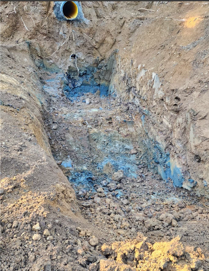
Oonah Road Far East
- Dig out of slip on the bend has exposed a secondary old pipe and the new fill sitting on top of the old road
- Water is disappearing into the ground before reaching the upstream culvert
- The road drain had been filed with loose rock that was washed away during the flood event
- These drains are being reinstated with appropriate backfill and reshaped.
- New culverts and upgrading existing broken culverts will continue
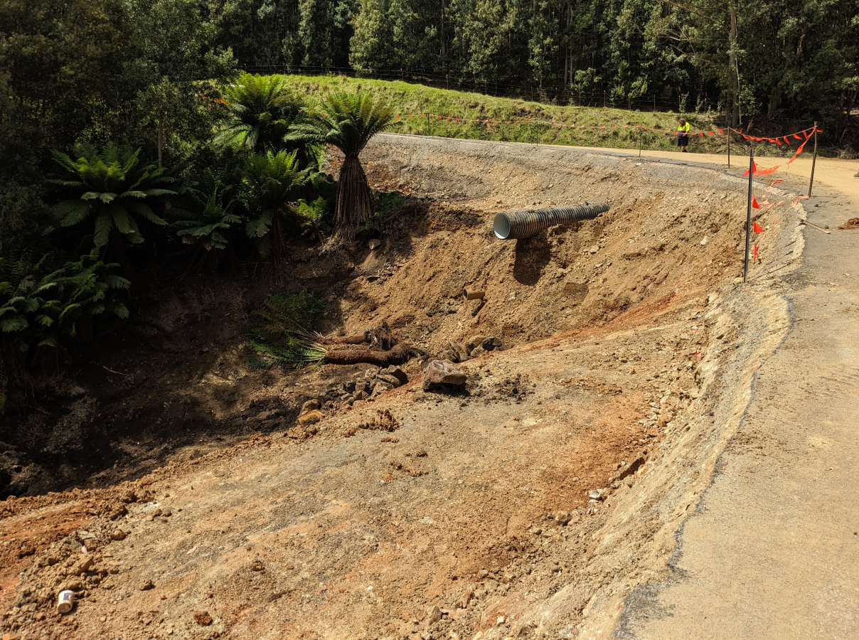
New road fill sitting on top of the old road
Dig out on slip end has exposed a secondary old pipe
Oonah Road East
The Sheet pile design is being finalised which will be required prior to the major excavations works.
Oonah Road (Douglas Road)
Contractor Harding Hotmix will commence on site the third week of December. They will begin replacing the culvert and rebuilding the embankment.
Thank you so much to the community for your patience as we rebuilt this road.
29 September 2023
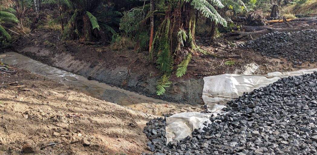
Oonah Road West - Completed
Asphalt has been laid with culverts and rock fill drains free flowing with water.
Civilscape have done an excellent job given the amount of unknowns at the start and working through some very wet weather over winter.
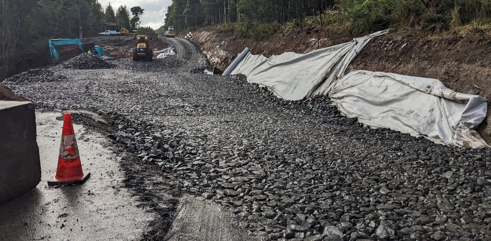
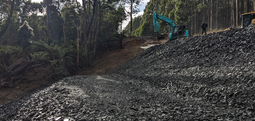
Oonah Road East
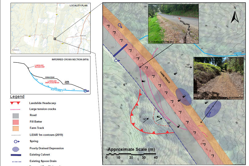
Design works have now been completed with major excavation works required to remove the landslip material (see diagram section A-A). Once the material has been removed, the road will be reinstated to the same alignment.
Corner works will be completed at the same time which includes the fill batter repair, culvert extension and road drainage improvement.
Civilscapes will commence works in early November.
Thank you so much to the community for your patience as we rebuilt this road.
21 July 2023
Oonah Road West - OPEN
Civilscape have done remarkably well to have removed so much unsuitable material and place an extraordinary amount of rock in just 5 weeks, especially given the weather conditions.
Oonah Road West will be re opened to the public from 5pm this afternoon (Friday 21 July). Gravel Road and Road Work signage is still in place with maintenance work to continuing next week.
Oonah Road West will re-open at 5pm on Friday 21 July 2023
1600 tones of rock was brought to the site
Thank you so much to the community for your patience as we rebuilt this road.
14 July 2023
Oonah Road West - Closed
Some small set backs. Oonah Road West will be closed for another week due to delays in laying the final road base.
Civilscape are currently digging out the last ramp drain, and will be laying the final road base gravel over the current loose rock within the next few days.
Oonah Road East - Road Remains Closed
Geotechnical investigations are showing that Oonah Road East is still an active landslip. Underground wells and movements are continuingly being monitored. For the publics safety, Oonah Road East will remain closed to all traffic until further notice. Final remediation designs for restoration are ongoing.
Thank you to the community for your understanding as we continue to work hard for you on repairing these roads
07 July 2023
Oonah Road West - Closed
We're almost there!
Civilscape imported around 1000T of rock yesterday and will have around 600T more by the end of today (Friday 7 July).
Water is freely draining at the bottom of the rock fill per the drainage channels. All going well next week (weather permitting) road gravel will go on and prepped to hopefully open the road next weekend.
Oonah Road East - Road Remains Closed
Geotechnical investigations are ongoing.
25 May 2023
Oonah Road West - Closed
During reconstruction works, unsuitable material has been located at the subgrade level.
The road will be closed between Martin Place and Douglas Road for up to four weeks whilst the unsuitable material is removed and the road reconstructed. Council apologise for the delays.
Unsuitable material located at the subgrade level
Oonah Road East - Road Remains Closed
Geotechnical investigations are ongoing.
Thank you to the community for your understanding as we continue to work hard for you on repairing these roads
14 April 2023
Oonah Road West - Road Open to Single Lane Only
Civil scape contracting are currently placing and compacting sub-base material in preparation for top base material.
About 70% of the remediation works have been completed on Oonah Road.
compacting sub-base material
compacting sub-base material
Oonah Road East - Road Remains Closed
Oonah Road East will remain closed to all traffic until further notice as a final design for restoration is still to be confirmed.
Thank you to the community for your understanding as we continue to work hard for you on repairing these roads
3 April 2023
Oonah Road West - Road Open to Single Lane Only
Consolidation work is near complete on the East Bound lane with drainage work commencing on the west bound lane.
Fun fact to date nearly 2,000tons of ballast material (blue metal) has been imported to site, considering this comes in at the rate of 36tons per truck load - that’s a lot of truck loads!
Consolidation work may be finished within two weeks (weather dependant) then work can start rebuilding the road to final level.
Laying the ballast material
commencing drainage works on the west bound lane
Oonah Road East - Road Remains Closed
Oonah Road East will remain closed to all traffic until further notice as a final design for restoration is still to be confirmed.
Thank you to the community for your understanding as we continue to work hard for you on repairing these roads
10 March 2023
Oonah Road West - Road Open to Single Lane Only
Repair work to Oonah Road West was affected by 45mm of rain through the week.
Excavations are continuing in order to establish a firm base for rebuilding the road. Site workers have exposed a number of subterranean drains - as remediation work continues.
Excavations are continuing
subterranean drains exposed
Oonah Road East - Road Remains Closed
Oonah Road East will remain closed to all traffic until further notice as a final design for restoration is still to be confirmed.
Thank you to the community for your understanding as we continue to work hard for you on repairing these roads
3 March 2023
Oonah Road West - Road Open to Single Lane Only
Contactors have removed and stockpiled the existing gravel layer and will mix it with road gravel to reinforce it's strength.
The lower culvert embankment excavation works have commenced, with water beening discovered entering from the uphill side and getting under the culvert. It appears to be old water trapped in the embankment.
Test holes either side of culvert will be cut to determine the extent of embankment water. This section will be monitored to see if any more water appears.
existing top gravel layer is removed
new drainage being installed
Oonah Road East - Road Remains Closed
Oonah Road East will remain closed to all traffic until further notice as a final design for restoration is still to be confirmed.
Thank you to the community for your understanding as we continue to work hard for you on repairing these roads
24 February 2023
Oonah Road West - Road Open to Single Lane Only
Contractors have commenced remediation work on Oonah Road West.
Works to rebuild the road include
- Clearing of trees on northern side of the road as well as any overhanging trees on the southern side.
- Upgrading culverts to dewater existing southern side of road
- Excavating the slip approx. 2.0m to a sound subgrade level
- Reconstruction of the pavement in layers to ensure stability
- Seal the road
(above) Remediation work begins at Oonah Road West clearing overhanging trees
Oonah Road East - Road Remains Closed
We are still some way off identifying the most suitable solution for this part of Oonah Road, and subsequently Oonah Road will be closed in to the near foreseeable future.
30 January 2023
Oonah Road West - Road Open to Single Lane Only
Continue monitoring of this site has shown no further movement. It has been concluded that the road failure is due to improper fill and compaction on the downhill lane.
Repair work to Oonah Road West will commence in the next few weeks and will include:
- Rebuilding the downhill lane
- Creating and upgrading drainage systems to properly direct storm water run off
- Resealing of the road
Oonah Road East - Road Closed
Oonah Road East has sustained significant land movement and is still an active slip.
Investigation work in this area is still continuing to identify the best sustainable solution.
Potential options being considered:
- Retaining wall to hold the slip
- Realign road uphill into the less impacted area
Land acquisitions may be required, depending on the solution.
We are still some way off identifying the most suitable solution for this part of Oonah Road, and subsequently Oonah Road will be closed in to the near foreseeable future.
Thank you to the community for your understanding as we continue to work hard for you on repairing these roads