Updates 2022
Friday 16th December 2022
Geotechnical engineers are continuing to monitor the site for movement.
Sample results from the test pits and drilling sites from three locations (2 Oonah Road locations and Upper Natone) are still to be determined.
One lane of traffic continues to remains open with a load limit of 5 tonne. We kindly ask the community to ensure that the temporary traffic management that has been installed (flagging, pickets and signage) remain in place, for the publics safety.
Friday 9th December 2022
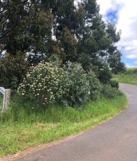
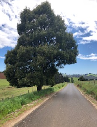
Oonah Road & Horseshoe Bend
Oonah road: The cracks within the road extend across the entire width of the road and into the natural soils above and below the road. The displacement and movement in the road continues (even without any traffic).
• Test pits and drilling at all three landslides (2 Oonah Road locations and Upper Natone) have been submitted for valuation.
• Final results will be revealed next week, with engineers to discuss the findings and formulate a remediation plan going forward for each site.
Horseshoe Bend: Consultant engineers continue to evaluate alterative roots in and around the area.
Oonah Road
Drilling for test samples
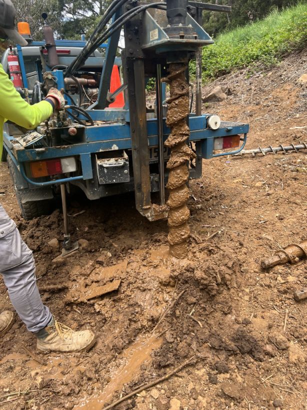
Drilling for test samples
Friday 2nd December 2022
- Clean-up works have been completed by Civilscape and the site is in good order for initial remedial works.
- The preliminary inspection work is complete and test holes have confirmed the slip plane.
- For the moment, the movement has stopped, which will allow us to move forward.
- The hazardous trees have been cut back with temporary repair work complete to allow safe access.
- One lane is open to light vehicles only (up to 5 tonnes) as of Friday morning!
- The next monitoring survey is scheduled mid-next week for further updates.
- Work is continuing to determine the best long-term recovery options, including exploring an alternative route.
Thank you so much for the communities patience and the positive responses we have received as we continue to work hard for you on what we know is a huge issue to your area.
Friday 25th November 2022
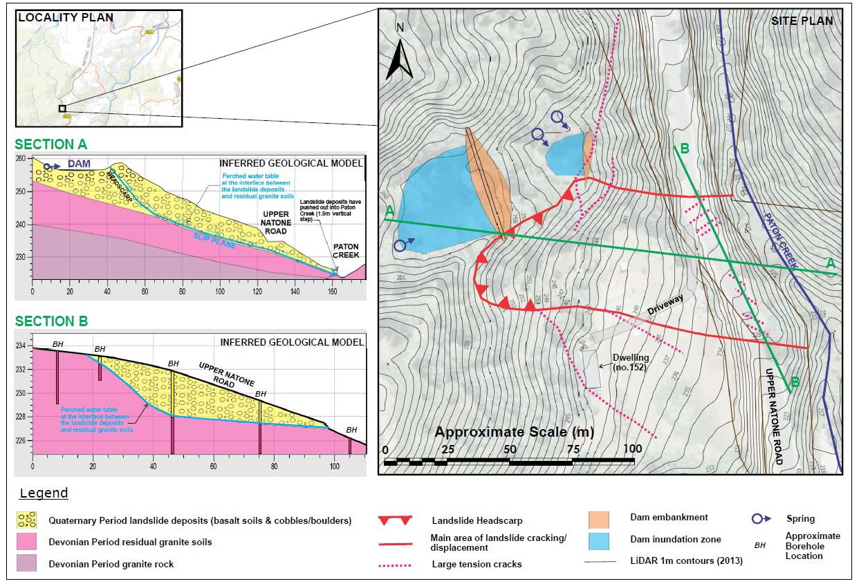
Geotechnical drilling has commenced within the landslide effected area of the road
Initial drainage works have been conducted and survey monitoring readings indicate that only very minor movement has occurred recently, as such it was considered safe to conduct drilling works.
Several boreholes have been drilled with temporary groundwater monitoring wells installed. The initial boreholes and further observations indicate/confirm the following:
- The landslide effected area within the road typically consists of basalt derived landslide deposits, overlying residual granite derived clays
- The interface between the basalt derived landslide deposits and the residual granite clays is soft and saturated and interpreted as being the slip plane of the landslide feature
- The slip plane in this area is located at a depth of approximately 1m to 4m below the road
- The slip plane has a relatively shallow dip angle within the uphill side of the road, before increasing significantly beneath the downhill lane
- Seepages below the road, on approach to Paton Creek, have almost completely dried up.
Further drilling work is required to further define the landslide effected area and identify possible remediation options. This work will begin on Tuesday 29th November 2022.
Based on the survey monitoring results, drainage works and the initial subsurface information, the uphill lane of the road through the landslide effected area can be opened to light vehicles only.
However, before the lane can be reopened some minor roadbase gravel will be required to smooth over the humps and minor steps. Also, the overhanging/leaning trees located to the north along the failed/slumped cut batter slopes, are required to be cut down.
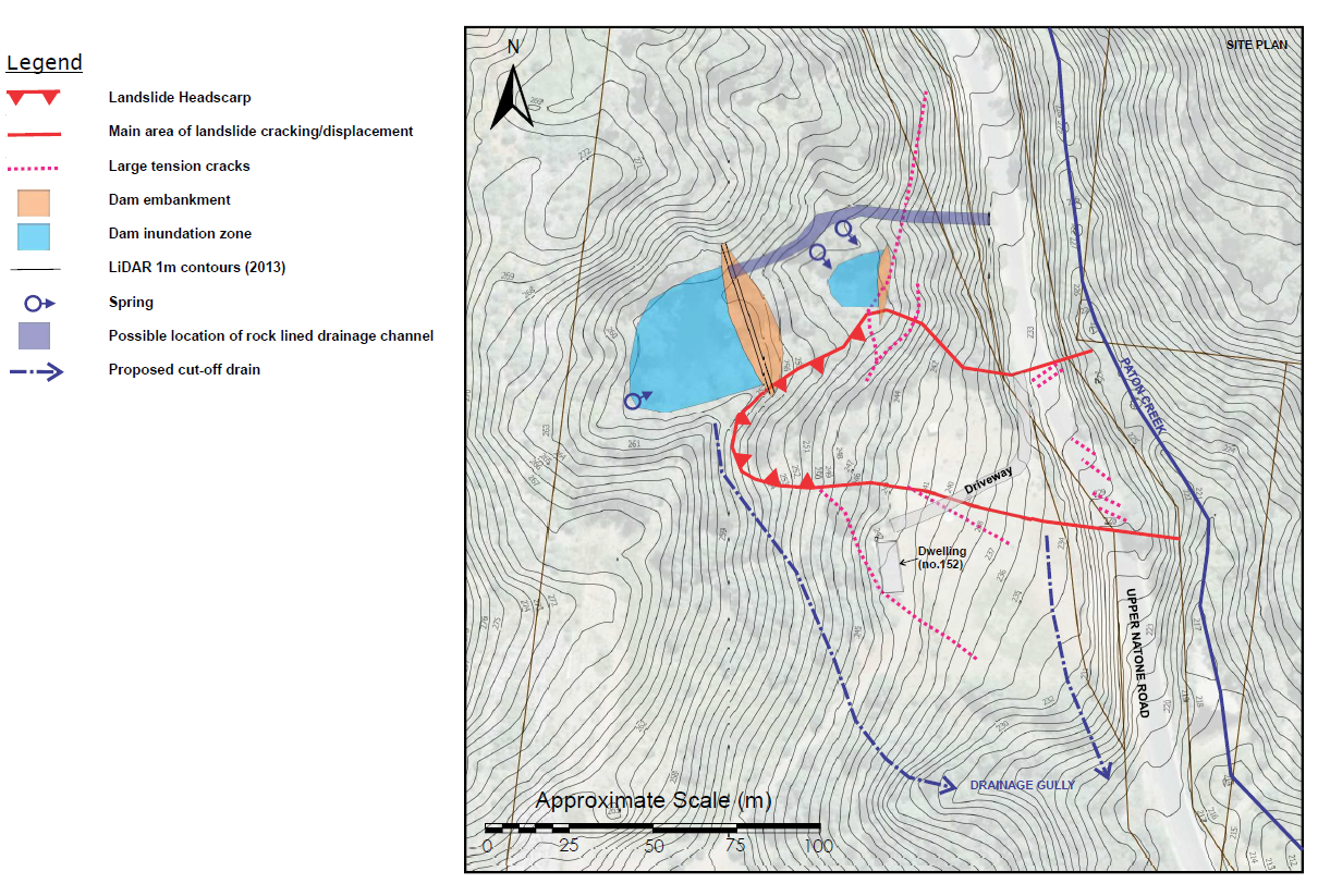
Currently the dam is empty, however if a significant rainfall event is to happen then the drainage works currently in place will most likely not be sufficient. As such, the dam will fill and then potentially spill over into the landslide headscarp. If this is to happen then the road will need to be closed again. A large pump will be on standby to assist in this matter. This will be required until the drainage remediation works can be undertaken.
Friday 18th November 2022
The spring feed dam located above Upper Natone Road - has been drained and no major cracks were found in the dams foundations.
Surveyors have been engaged to develop a grid survey to monitor the sites movement. This will commence today, Friday 18th November.
Geotech engineers have already noted that the slippage area has slowed considerably and seepage has also reduced. Geotech engineers will continue to monitor movement from the active slip.
Some trees will be removed along the banking and once further results are obtained from the Geotech investigations, we will work towards re-opening one lane as soon as possible.
Council has engaged Civil Engineering Specialists to oversee all design and construction works to effect repair of the road and remediate the surrounding slip area.
Natone community, we listened to your other concerns regarding road maintenance in and around your area at the public meeting last week - and we have acted.
Contractors have been engaged to review and remove all low hanging branches from the south Riana/Upper Natone intersection through to Blyth Bridge.
19 Trees are scheduled to be removed from Camena Road to increase visibility and safety for all road users.
Verge maintenance will commence on upper Natone road starting early 2023.